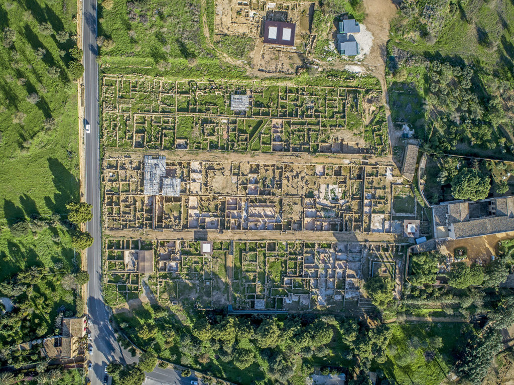
When the Romans arrived in Agrigentum in 210 BC, many citizens settled there, together with people from other parts of Sicily. Archaeological evidence from the settlement clearly shows that in Roman times, the perimeter of the city was reduced considerably, while maintaining the Hellenistic urban organisation of ancient Akragas.
In the 1950s, the first technologies based on
aerial photogrammetry
allowed
Schmiedt
and
Griffo
to produce photos that, thanks to aerial framing, made it possible to appreciate the city’s urban layout,
Hippodamian
in type, with
stenopoi
and
plateiai
that created blocks of 35 metres by crossing orthogonally.
In order to study the network of roads that crossed the urban centre in ancient times even more closely, today the Archaeological Park of the Valley of the Temples conducts investigations using
remote sensing
, in collaboration with other research institutions.
Despite the reduced perimeter of the urban area, from the 2nd century BC the city of Agrigentum experienced a period of monumentalisation not only of the public area, with the construction of the forum, majestic porticoes and sanctuaries, but also of private houses, which were increasingly sumptuous and built according to the layout of the Roman domus.

While respecting Greek tradition, Rome as a coloniser clearly left its mark in the city’s physiognomy, the result of which is a mixture of styles still evident today in the archaeological site.